
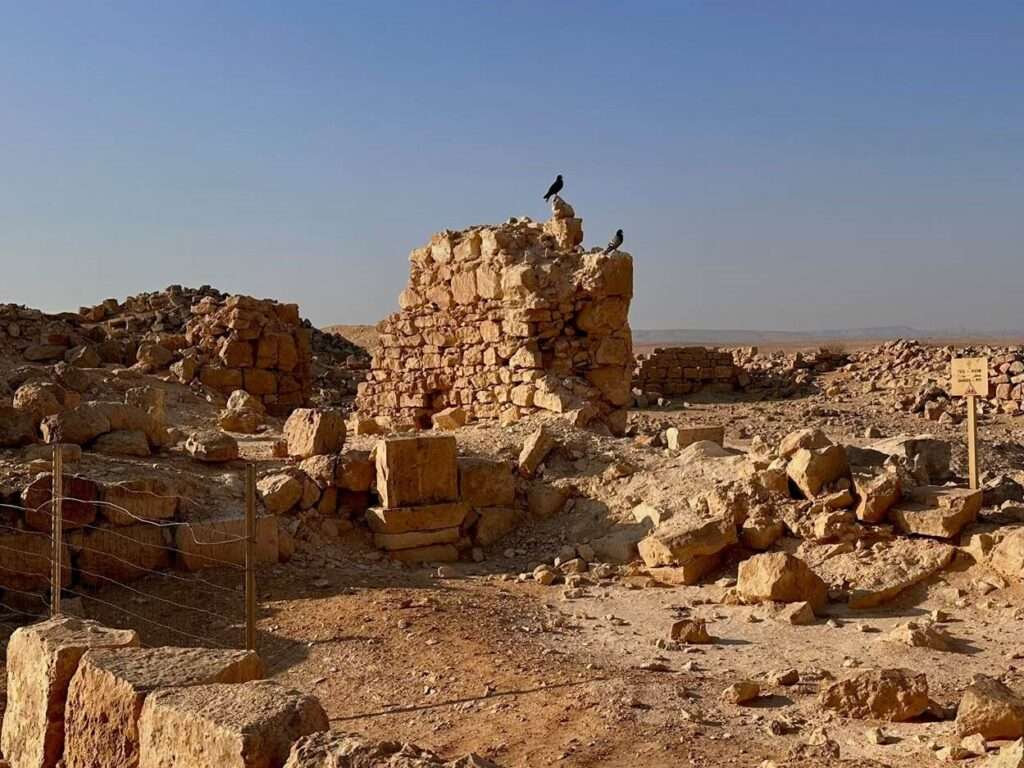
A new study published in the leading journal PNAS presents an artificial intelligence-based method that enables the analysis of hundreds of thousands of building stones by measuring each stone individually. An analysis of some 250,000 stones at Shivta in the Negev, from the level of individual walls to entire neighborhoods and the settlement as a whole, revealed differences in building traditions between different parts of the settlement and between different periods. The study also identified a previously unknown ancient boundary and reconstructed the stages of the settlement’s expansion.
A new study conducted at the University of Haifa and published in the journal PNAS presents a method based on machine learning that facilitates the measurement of the size, shape, and layout of hundreds of thousands of building stones at an entire archaeological site. Until now, building characteristics have been examined primarily by dividing them into broad categories or by taking manual measurements in individual structures. For the first time, the new method makes it possible to compare walls, houses, neighborhoods, and entire settlements quantitatively, and to identify changes in building traditions over time. applying this method for the first time at Shivta in the Negev, the researchers identified clear differences in building quality between different parts of the settlement, found evidence of an ancient boundary that ran through its territory, and reconstructed its expansion from a southern core toward the north and west. “Technological advances now allow us to analyze the remains of structures across an entire site—something that was not possible through manual measurement of building stones. The extensive quantitative data offer new insights even at sites that have been studied for decades,” said doctoral student Erel Uziel of the University of Haifa, one of the study’s authors.
Shivta, which flourished during the Byzantine period in the Negev, is one of the best-preserved ancient stone settlements in the region. At its peak, the settlement covered an area of approximately 25 acres and served as a regional center for agricultural communities whose livelihoods were based primarily on grape growing and wine production. Despite the settlement’s exceptional state of preservation, questions concerning the stages of its development and differences in building characteristics between its various parts have remained largely unanswered. Until now, systematic measurement of building stones has involved labor-intensive work; as a result, studies of this kind have generally focused on individual structures rather than entire settlements. In the present study, doctoral student Erel Uziel, Dr. Yitzhak Jaffe, Prof. Gideon Avni, and Prof. Guy Bar-Oz of the School of Archaeology and Maritime Cultures at the University of Haifa, together with Prof. Gary Feinman of the University of Chicago, sought to determine whether computerized analysis of building stones could be used to reconstruct the stages of Shivta’s development, identify changes in the settlement’s boundaries, and examine differences in investment in construction between its various parts.
The researchers mapped the site at Shivta using a drone and photographed approximately 600 standing walls. The system they developed analyzed the photographs and created a database containing approximately 250,000 stones from collapsed walls and approximately 12,000 stones from standing walls. The researchers measured the size and shape of the stones; in the standing walls, they also examined the arrangement of the stones and the gaps between them. Based on these measurements, they created a detailed map of building characteristics throughout Shivta, from the level of individual stones to that of entire neighborhoods. The researchers then combined the data with previously available archaeological information about the sequence in which structures were built and the different periods in the settlement’s history, in order to identify patterns of expansion and change.
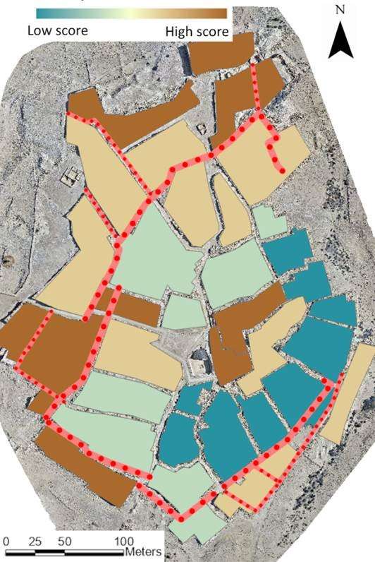
The map created by the researchers revealed differences in building characteristics and quality between different areas of Shivta. The average surface area of stones in the outer walls surrounding Shivta was approximately 15 percent greater than that of stones in interior walls. A similar pattern was identified along the course of an internal wall that encloses part of the settlement’s central area and apparently marked its boundary in an earlier period. Combined with existing archaeological evidence, the findings indicate that the settlement began to develop in the second and third centuries CE in the southern area, where relatively small houses were built. During the main period of growth, between the fourth and sixth centuries CE, the settlement expanded northward and westward. Larger houses were built using larger, more regularly shaped stones, and three churches and additional public buildings were also constructed. “The method we have developed makes it possible to examine not only how ancient settlements evolved, but also how building characteristics and the scale of the resources apparently invested in construction varied between houses, neighborhoods, and different periods. In the future, this information could be combined with a quantitative assessment of the labor and resources required for construction, opening up new avenues for investigating social and economic differences in ancient communities in Israel and around the world,” said Dr. Jaffe.